Understanding the Army Corps of Engineers’ Official Rules for Wetland Permitting

Photo Of Wetlands - CW Courtney Company

When choosing an area for development, the Army Corps of Engineers’ official rules for permitting need to be considered. The rules are designed to protect water resources, but they can be tricky if the builder isn’t used to dealing with wetland management practices. Any waterway that is “navigable” or has a “significant nexus” to navigable waters is under the rules governing wetland management. There are several steps to gaining the proper permits for development in an area that may impact a wetland.

Report from a Consultant

First, the land will need to be assessed by a qualified consultant. A wetland stream assessment includes mapping, and yields important information about whether there will be issues with endangered species or habitat destruction.

The initial assessment can determine whether or not it will be profitable to move ahead with a proposed building project. The presence of endangered species or a specialized habitat may make a property too expensive to develop, in light of necessary permits and the possibility of legal roadblocks.

The Permitting Process: Step One – Delineation

Once an initial assessment is completed, the consultant or team can compile a more detailed report. Without this report, no permit can be issued. This is the official report that details the type of wetland on the property, its exact location, and its scope. If the project moves forward, this report helps guide decisions on how to reduce the environmental impact, if necessary.

The Permitting Process: Step Two – Determining Jurisdiction

Once the delineation report is complete, the Army Corps of Engineers will send an individual or team to visit the site. They will review the report to determine whether the area is under their jurisdiction and whether a permit is required.

The Permitting Process: Step Three – Permit Issuance and Mitigation

Once the Army Corps of Engineers reviews the report and determines jurisdiction, they will determine what permits, if any, are required. The type of permit(s) issued will determine what types of mitigation are required. Mitigation may be accomplished by the payment of fees as specified on the EPA Wetland and Stream Mitigation web page, or by the submission of a plan that presents the ways in which the build will be adjusted to minimize the impact on the affected waterway.

Attention to detail, and the expertise of qualified, experienced engineers at each stage of the process will help ensure that the finalized project is legally compliant.

Photo Credit: U.S. Fish and Wildlife Service Northeast Region

FEMA Flood Insurance Facts

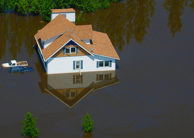
Photo Of A Flooded House - CW Courtney Company


One of the most common and costly natural disasters, floods cause billions of dollars in damage each year in America. But because standard homeowners insurance doesn’t cover flooding, residents are left to fend for themselves. The only safeguard millions of them have against rising waters is coverage from the National Flood Insurance Program (NFIP).

What Is It?

The NFIP was created by Congress in 1968 to give property owners protection against financial loss from flooding. As long as they reside in a community that participates in the program, homeowners, renters, and business owners can obtain affordable insurance coverage through the NFIP. Because they are located in flood-prone areas, participating communities are expected to comply with FEMA requirements intended to reduce the risk of flooding. At last count, there were nearly 5 million NFIP policies in more than 20,000 communities across America.

Who Needs It?

All of the communities that are eligible for insurance coverage are located in flood zones. According to FEMA, high-risk areas have as much as a one-in-four chance of experiencing a serious flood during a 30-year mortgage. As such, property owners in these communities must purchase NFIP coverage by federal law. Because their risk of flood damage is considerable, they typically pay higher premiums than those in less vulnerable areas.

About 20 percent of NFIP claims come from property owners in moderate-to-low risk areas. Although not federally required to purchase flood insurance, it is strongly recommended for home and business owners. Because the risk of a flood is quite low in many of these areas, coverage can often be obtained for under $100 a year!

What It Covers

Flood insurance through the NFIP provides both building and contents coverage.

Building insurance includes:

– The structure itself (whether home or business)
– Electrical and plumbing systems
– HVAC equipment
– Refrigerators, stoves, and built-in appliances
– Permanent carpeting

Contents coverage includes:

– Curtains
– Portable appliances
– Clothing and other personal items
– Electronics
– Furniture

As a general rule, policy holders with damaged property are reimbursed through one of two methods: Actual Cash Value (ACV) or Replacement Cost Value (RCV). Depending on the policy, damage to the structure is generally insured to within 80 percent of its RCV.

Flood insurance through the NFIP is a godsend for millions of Americans living and working in flood-prone areas. It allows them to obtain comprehensive coverage for their home or business at an affordable price.

Photo Credit: DVIDSHUB of Flickr

The Case for Trenchless Technology and Utility Installations

The C. W. Courtney Company

Traffic is an unavoidable fact of modern life, and it’s getting worse. According to a recent report, the average American commuter spends 42 hours a year stuck in traffic. Engineers are exploring faster, more efficient ways to make necessary updates and repairs to underground infrastructure to combat this growing problem. Trenchless technologies are often the least expensive and least disruptive options.

What Are They?

As the name implies, a trenchless technology is one that requires few or no continuous trenches. A type of subterranean construction work, it is generally used to install, replace, or repair underground infrastructure, including water, sewer, gas, and industrial pipelines. It can also be used for electrical conduits and fiber optics. Because trenchless technologies require minimal excavation, they are considered a marked improvement over traditional open-cut construction methods.

The Benefits

Although they can be utilized anywhere, trenchless technologies are especially attractive in urban areas with high pedestrian and vehicle traffic. Here’s why:

  • Faster – Even with the right equipment, trenches take a long time to dig and later refill. Skipping this step can save the average construction crew several hours or more.
  • Less disruptive – Digging up streets, sidewalks, and local properties not only takes time, but it also takes room. As such, it is often necessary to shut down portions of the area, which can lead to traffic jams, detours, and other inconveniences.
  • Fewer accidents – Although uncommon, it is possible for crews to damage or destroy existing utilities during excavations.
  • Cheaper – Because up to 70 percent of the costs of open-cut methods are for excavating and refilling, trenchless methods can save builders a bundle. According to some experts, they may be up to 50 percent cheaper.
  • Fewer social costs – The equipment that is needed to dig large holes in pavement or earth causes a lot of noise and air pollution. These are costs that must be borne, without consent, by local residents.

Utility Installations

While it’s highly effective for replacements and repairs, trenchless technology is even better when it comes to installations. A small subsurface tunnel is all it takes for construction crews to put in new service lines for water, gas, electric, and telecommunications. Trenchless methods and techniques can also be used to install new utilities under rivers, canals, and railways with minimal surface disruption or damage to the environment.

With all those advantages, it is clear that trenchless technologies are vastly superior to traditional open-cut methods.

Poor Condition of America’s Infrastructure

What Is Infrastructure?

Every person in the nation needs infrastructure to exist. Infrastructure encompasses a wide variety of services, including local water mains; power lines that connect individual houses with the electrical grid throughout the country; roadways that connect homes to schools, stores, and places of employment; and the national highway system that connects points throughout the nation.

The Grading Process

Every four years, civil engineers in the United States evaluate the nation’s infrastructure categories. With this evaluation comes an assessment of the condition of these systems. This report card is called the ASCE’s Report Card for America’s Infrastructure.

A council of experts assigns grades according to eight criteria. These criteria include capacity, condition, funding, future need, operation/maintenance, public safety, resilience, and innovation. Over the last 15 years, every grade has been perilously close to failing. Most grades average in the D range. These grades are largely because of delayed maintenance and a lack of investment in general.

Solutions

Solving these problems requires a plan and a commitment to realistic changes. Solutions are possible, but will take effort.

  •  Leadership must adopt vision and goals at the national level to realize improvements. Legislators are in the unique position of instituting effective changes to these systems.
  • Transportation systems must be designed to withstand the challenges of today and tomorrow. Resilient designs and ongoing maintenance are two keys to improving national infrastructure.
  • Investment must increase wherever possible. These investments will serve national goals and individual systems that make up the national infrastructure.

Recognizing and highlighting these problems makes it possible to work toward real and lasting improvements in these crucial systems.

Emergency Roadway Repair Utilizing Soil Nailing

Soil erosion is the leading cause of road failure in areas where stream beds run along existing roadways. Often caused by downpours, rainwater runoff can flood nearby roads, transforming them into impassable waterways. And when overflowing streams saturate the soil on steep slopes, they can precipitate landslides. In the United States, dozens of people die each year from these weather-related events.

What Is Soil Nailing?

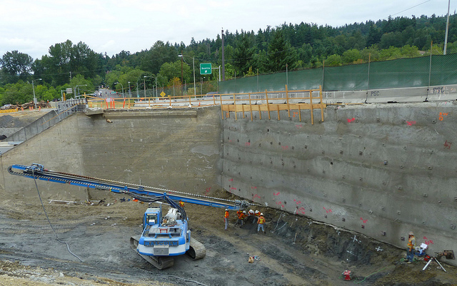
A proven earth retention technique, soil nailing is used in areas where erosion and/or landslides are a concern. By inserting large steel bars, “nails,” into the soil mass, the process can promote soil stability on a temporary or permanent basis. Significantly faster than competing methods, soil nailing provides a resisting force against landslides and other types of slope failure. Here’s how it’s done.

Soil Nailing in Practice

When a large section of Berkshire Road in Gates Mills, Ohio failed after a heavy downpour, village officials knew they had to settle the matter once and for all. Because a large stream parallels the roadway, erosion problems had become an ongoing issue. Officials called in the CW Courtney Company to find a cost-effective repair option.

After examining the stream bank and nearby roadway, the company recommended a repair strategy that included soil nailing, floodplain creation, and vegetated rock stabilization. According to the engineers, the project would not only produce the desired results, but it would also save the village between $50,000 and $100,000 over more traditional construction strategies. The project’s timeline would also be shortened from 4 weeks to 2 weeks. After the village approved the project, the CW Courtney Company supervised the proposed repairs.

Soil Nailing Benefits

An increasingly popular option, soil nailing has several advantages over other construction methods, including the following:

– Works in tight spaces
– Minimal shoring needed
– Less construction, resulting in fewer traffic obstructions
– Less impact on the environment
– No restrictions on wall height
– Works with existing wall systems
– Permanent or temporary use
– Compatible with irregular shapes

Potential Limitations

Soil nailing should not be used in every case of roadway erosion. Proper analysis and land surveying will help decide if this solution is the best option. Here are a few possible restrictions:

– Soil contains too much sand, rock, or gravel
– Area is in a high water table
– Sensitive and expansive soils may not provide the stability needed for permanent insertion

Conclusion

In spite of those possible limitations, soil nailing is now a well-established technique. As seen in the case study, it has numerous applications and is most effective in flood-prone areas. Adding stability to these at-risk areas can reduce the risk of roadway failures caused by significant rain events.

Northeast Ohio Regional Sewer District Permitted to Operate Storm Water Management Program

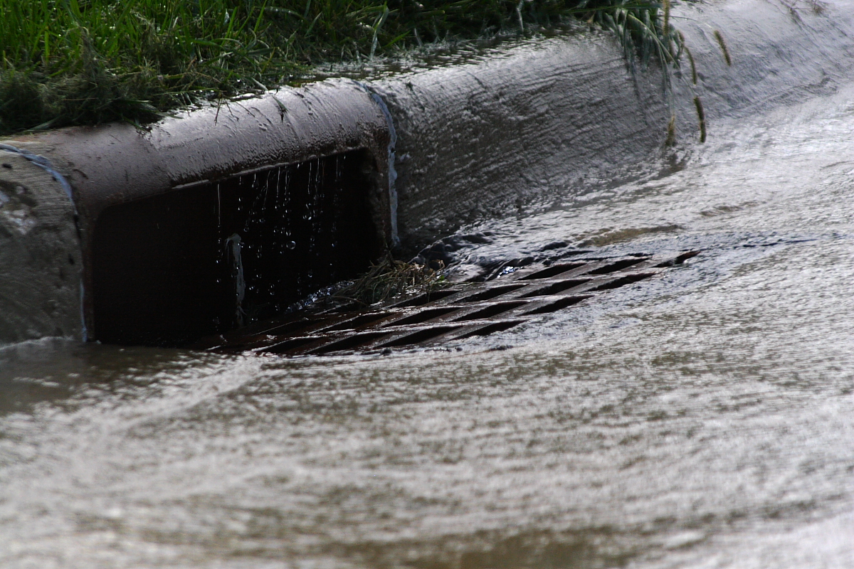
A storm drain - CW Courtney Company

The Ohio Supreme Court recently expanded the definition of wastewater to include storm water. With this victory, the Northeast Ohio Regional Sewer District can continue operation of its’ storm water management program. The Supreme Court also ruled that the Cleveland-area sewer district has the ability to collect fees to implement this storm water management plan.

A little background for anyone who hasn’t followed the case: the Northeast Ohio Regional Sewer District was created in 1972, providing wastewater management services in the 60 cities, towns, and villages in and around the Cuyahoga County area. In 2010, the sewer district developed a storm water management plan that would treat and dispose of all the region’s storm water. To fund storm water treatment, this plan included the collection of fees within the district.

Shortly after the implementation of this program, the sewer district filed a lawsuit hoping to confirm its authority to collect the necessary fees. Ever since 2010, the case has climbed through the legal system. The case revolved around the district’s established authority over wastewater, and whether storm water management fell under this jurisdiction. The Eighth District Court of Appeals ruled that the district was authorized to collect, treat, and dispose of wastewater, but it was not permitted to do so with storm water. The Ohio Supreme Court overturned that decision, stating that state laws, as well as the sewer district’s charter, authorize the district to establish the program and associated fee structure.

The court’s majority opinion was written by Justice Paul E. Pfeifer and supported by three Justices. It stated that storm water is a type of wastewater. Since the storm water management program would collect and treat storm water, the program does indeed fall within the sewer district’s authority. Justice Pfeifer cited statute R.C. 6119.09 as well as the organization’s charter language when concluding that the sewer district can not only establish and maintain the storm water management program but also collect fees.

The C.W. Courtney Company Proudly Designed Infrastructure for Battery Park

Crane C.W Courtney Company

The engineering experts at The C.W. Courtney Company have been busy providing services to extend the Battery Park housing development into the vacant property between West 73rd and West 76th Streets, north of Herman Avenue in Cleveland’s Detroit-Shoreway neighborhood. We partnered with Vintage Development Group to design the public infrastructure and other crucial elements in the development’s Master Plan.

The project involved extending the grid of the existing neighborhood to West 76th Street on the east and West 73rd Street on the west. Our engineers designed the infrastructure, which was completed back in 2006. The housing development is still under construction, but it has an extensive and advanced foundation to build upon. The infrastructure has been equipped with approximately 1,500 feet of sanitary main and appurtenances, 2,400 feet of water main and appurtenances, about 4,700 feet of storm/combination sewer lines of various sizes, and both gas and electric as well as other utilities.

The Battery Park site is home to the brand new Edgewater luxury townhome community. The Edgewater townhomes were designed to be stylish and contemporary, with upscale features and amenities that include granite countertops, bamboo floors, stainless steel appliances, and outdoor entertaining spaces. Many of the homes offer postcard-worthy views of Lake Erie and the Cleveland skyline.

The development is located at the former Eveready battery factory site above Edgewater Park. Home buyers have been drawn to the area for its accessibility to the downtown and University Circle areas and walking-distance proximity to the Gordon Square Arts District and countless local shops, restaurants, and bars. The location is also ideal for families who love the outdoors, as residents enjoy access to the pedestrian and bike tunnels to Edgewater Park and Lake Erie Beach.

Buyers who purchase a home at Battery Park will benefit from the 15 year tax abatement for new townhome and loft residences, so if you’re looking for a home in the Cleveland area, check out the Battery Park development. We’re proud to be part of such a great community project!

Special thanks to Ben Sutherland for the image of the crane.